Monsoon Weather Over Pioneer Valley
|
I spent twelve days in Pioneer Valley, northeast of Flagstaff, Arizona photographing the summer thunderstorms associated with the monsoon weather. I shot over 70,000 exposures to assemble a dozen time lapse movies. It was the most spectacular monsoon weather I have seen in many years. Every day brought new phenomena. Each mountain creates its own orographic clouds. Look for cumulonimbus clouds that spread out when they reach the stratosphere. Lenticular clouds hover over the mountains when the speed of the air mass increases.
I shot exposures at five second intervals to assemble time lapse movies. I produced a time lapse movie for each day of weather activity.
Monday, September 3
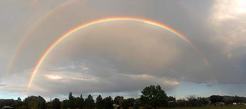
 6:28 PM: A rainbow appears briefly in the late afternoon.
Flagstaff Rainbow, September 3, 2012: You can buy this photo as prints as large as 8-7/8" x 20".
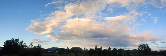
 6:49 PM: The remnant of a thunderstorm hangs high overhead.
 6:51 PM: Another cumulonimbus begins to dissipate severalmiles to the south.
Flagstaff Thunderstorm Remnants, September 3, 2012: You can buy this photo as prints as large as 12" x 36".
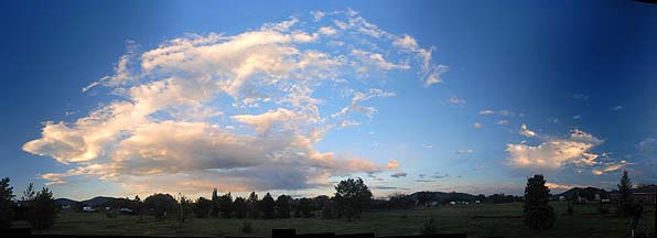
 6:52 PM: High-altitude cumulonimbus clouds are the last things illuminated by the setting sun.
 6:55 PM: The cumulonimbus remnant spreads across the upper troposphere.
Flagstaff Thunderstorm Remnant Sunset Panorama, September 3, 2012: You can buy this photo as prints as large as 12" x 24".
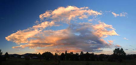
 7:01 PM: Rain falls from the cumulonimbus remnant and evaporates as it descends into the upper troposphere. The phenomenon is called virga.
 7:04 PM: The colors fade as the sun sets.
Flagstaff Thunderstorm Remnant Alpenglow Panorama, September 3, 2012: You can buy this photo as prints as large as 12" x 48".
Whenever I see the flash of lightning outside, I grab my camera and a tripod and go out in the rain.
 Put a copy of the Lightning 2013 Calendar in your Lulu.com shopping cart for $14.95.
 Send a message to Brian.